Even if we didn’t see any buffalos at “Buffalo Pound Provincial Park”, I got another chance in Boulder. This American city is home to the “University of Colorado” (CU), where I was studying for one year in 2010/11 with a Fulbright scholarship. It lies right at the bottom of the foothills of the Rocky Mountains with the iconic “Flatirons” rising just behind. The outside of the university buildings is kept in das sandstone bricks, giving it a Mediterranean flair.
The “Flatirons” are Boulder’s iconic mountainsMost buildings on campus have a sandstone facade, giving it a Mediterranean flair
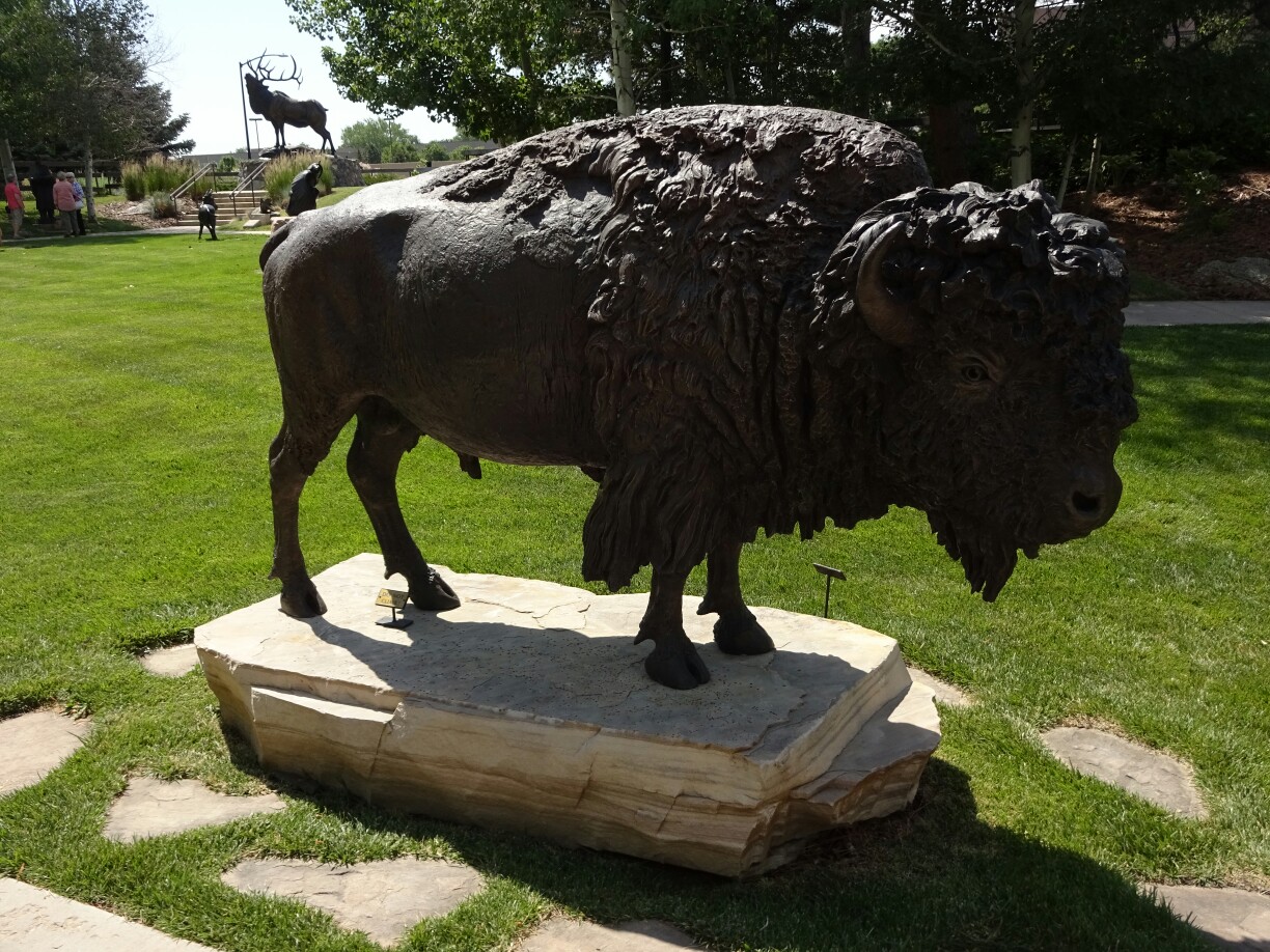
Together with Micki and John, my host parents in Boulder, I rediscovered the campus. We walked all over and had a look at the university museum in the old main building. Here, a exhibition was dedicated to Ralphie, a buffalo, which has been the mascot since 1934. Other displays included the numerous astronauts coming from CU, as well as several Nobel laureates and other famous graduates.
Visiting the university museum in the old main buildingOne of the displays covers the many CU graduates that went to space with the NASA
In another room we found a miniature model of several buildings from campus and the downtown area, all made of Lego. The copy of the “Folsom Field Stadium” was very impressive and featured a match between buffalos (CU) and ducks (“University of Oregon”). However, the large, buffalo-shaped swimming pool of the recently expanded recreational center did not make it for the model. It might be part of the new Lego landscape that is being build in the room next door.
The Lego campus had detailed miniature models of the universityThe buffalo-shaped pool was not yet part of the Lego landscape
Micki and John were probably the oldest “Buffs”, as CU students and alumni are called, that I had met during my time at the university. Six years later very few fellow students were still around. The ones I knew were Oscar, who had decided to stay for a full PhD program, and his girlfriend Marion, as well as Dan, who had been involved in “CU international”, organizing various activities such as dinners in different restaurants every Wednesday.
I stayed with Micki and John for my two weeks in BoulderWednesday dinner with Dan, Marion and Oscar as a continuation of the tradition
A few days after my arrival, took me to the track and field event of his “Boulder Roadrunners”. They organize competitions every two weeks, but this time it was “Olympic Day”. Unfortunately I could not participate, as I was still handicapped with my cracked clavicle. However, I was able to help out with the stopwatch, taking time for short and long distance running, steeple chase and the relay race. In their spare time the participants could talk to local Olympic medalists like Frank Shorter, who won the marathon in 1972.
Stopping the time for the 5km run was the most difficult, as participants started lapping each otherSteeple chase was one of the competitions at the “Olympic Day”
While Micki and John introduced me to their neighbors, friends and family, I also met up with other American Fulbright alumni: Cheryl in Denver and Gene and Keith in Boulder. With the spirits high, I accepted Dan’s invitation to the grand opening of the “Longtucky” distillery to meet even more locals. It is owned and operated by his sister’s fiance and his friend. Currently they are making rum and whiskey in their copper tanks, which are self-made just like everything else on their premises. This is also the reason why it took two years to make their dream come true.
The grand opening of “Longtucky Spirits” in LongmontEverything in the distillery was self-made by the owners, including the large copper tanks
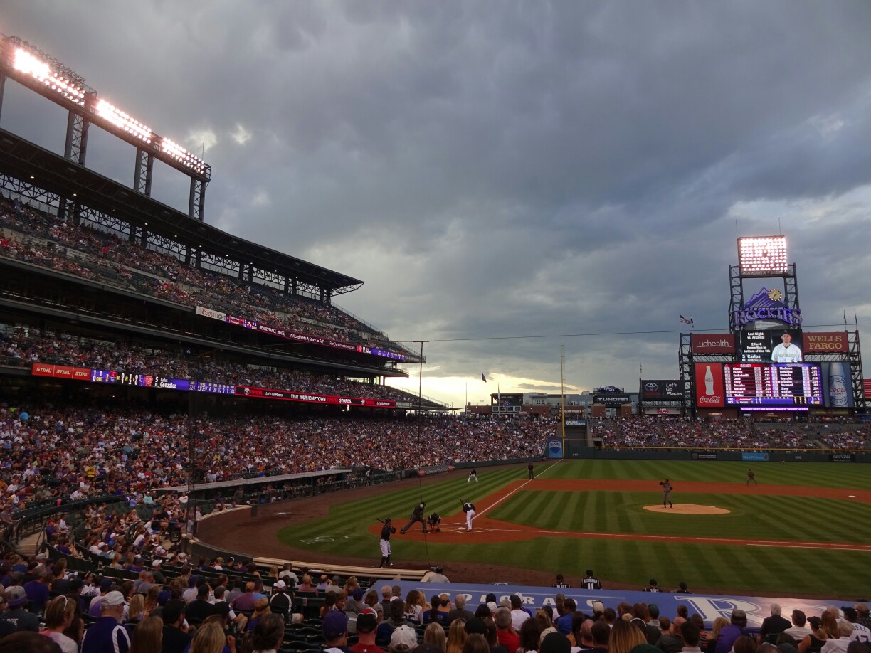
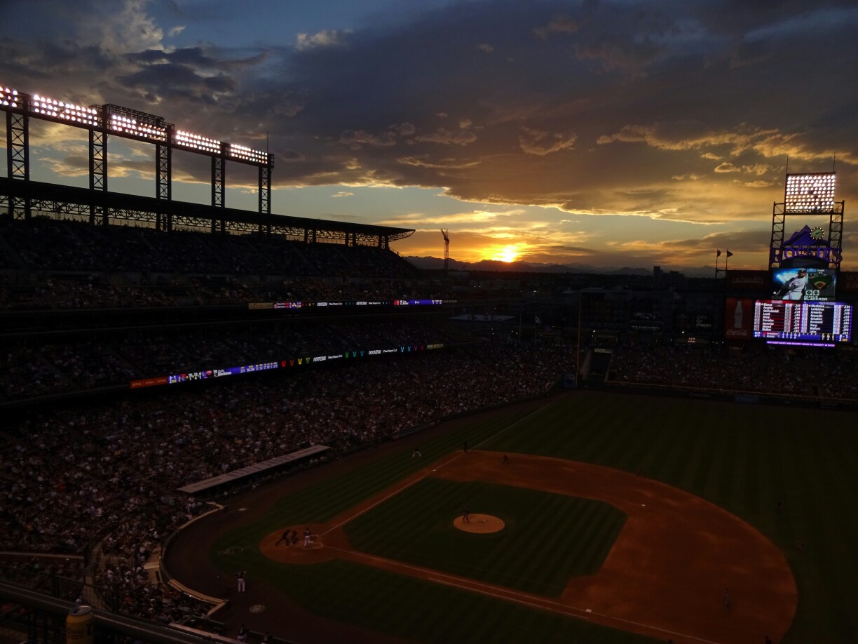
One night I joined Oscar and Taka for a baseball game at the “Coors Field Stadium” in Denver. That night the “Colorado Rockies” were playing the “Arizona Diamondbacks”. Unfortunately, the guest team had a lucky streak in the fourth inning, after which the score was 1-10 and the game was pretty much decided. So instead of keeping a close eye on the game, we went to the top of the stadium and watched the sun setting beautifully behind the “real” Rockies.
The good seats didn’t help with winning the gameUp high we were able to watch the sun setting behind the Rocky Mountains
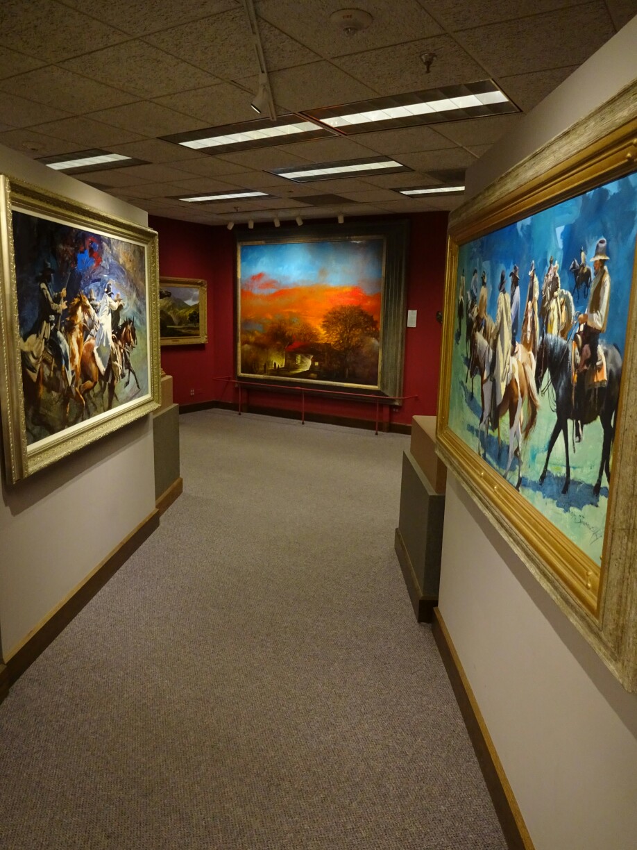
Another day Micki took me to the “Leanin’ Tree Museum” in North Boulder. It started out as a factory for greeting cards and later on Ed Trumble, the founder, added the museum, which displays his private western art collection. The garden houses several large scale sculptures, whereas the inside has mostly paintings in different styles. They depict cowboys, Native Americans, buffalos and the incredible diversity of nature in America’s west.
The garden at the “Leanin’ Tree Museum” was full of large scale sculpturesWestern art paintings were on display in the gallery
With a short stop in Vancouver, I headed back east to the prairies to the city of Regina. Canadians might know that this is the capital of Saskatchewan, but most of them have never been there. Why would I want to go there? The answer is simple – because I wanted to visit Steve and Jan, whom I had met in Argentina back in January. They live and work in this city, which is surrounded by endless fields and an open sky.
Strolling through downtown ReginaDelicious dinner with Dave, Steve and Jan
As they were still on their sabbatical leave, they took some time to explore the area with me. First, we visited the “Buffalo Pound Provincial Park”, where the Indians, or first nations as they as called here, used to chase herds of buffalo over the steep edge on top of the river hill so that they would fall and break their neck. Nowadays it’s rather peaceful and the buffalos are kept in an enclosure. Unfortunately it is quite large and covered with many trees, so that we didn’t get to see any.
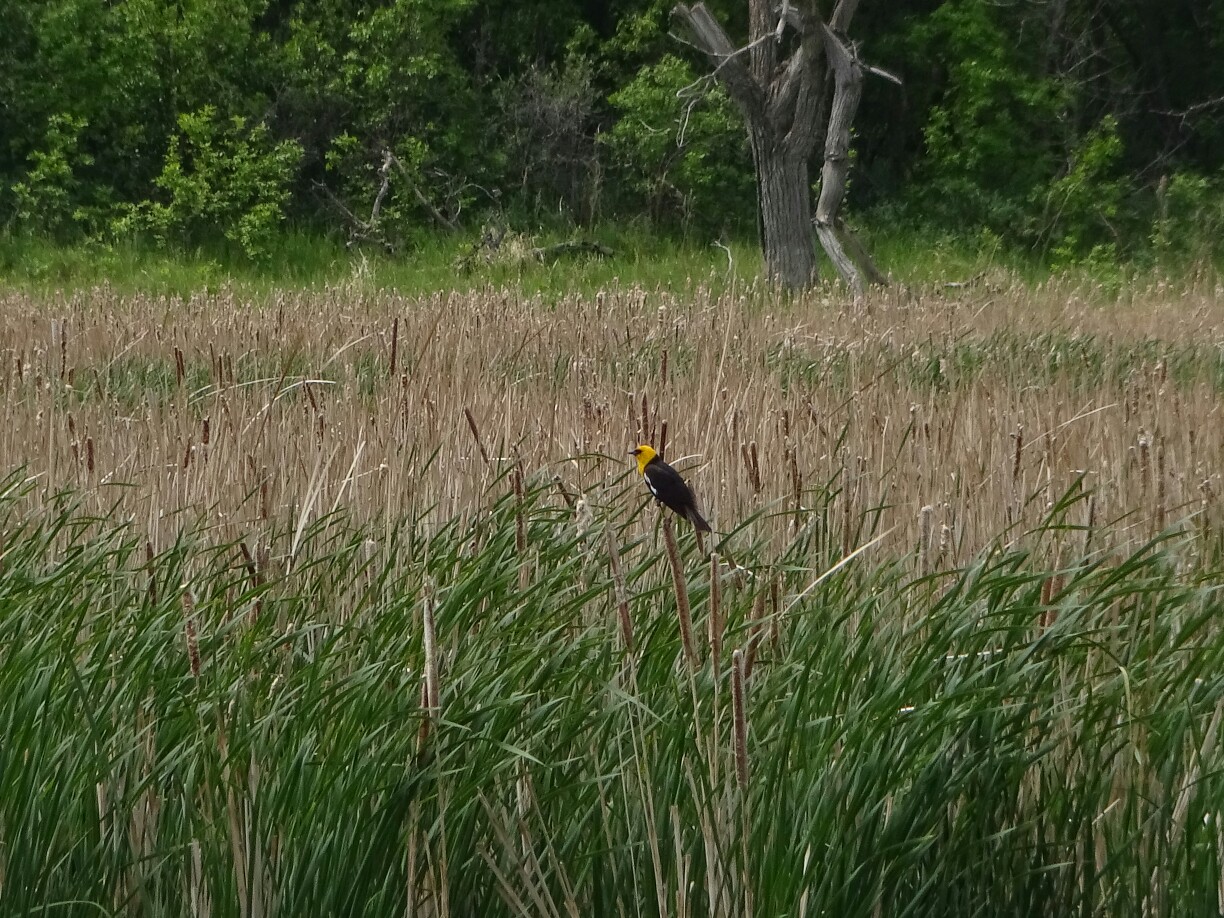
The trees and bushes provide lots of hideouts for the buffaloes“Buffalo Pound Provincial Park” is home to many different birds
Instead we went on a little hike around the “Nicolle Flats”, a swampy area that is home to many birds and other animals and insects. By the time we had completed a little less than half the way around, we realized that we had several ticks crawling up our pants. Somehow Steve seemed to be the most attractive for them for they had also managed to find their way underneath Steve’s long pants. We completed the rest of the hike in a hurry, eager to get some help to remove the ones that had already attached themselves.
A wooden boardwalk leads out into the swampI guess the birds don’t like the ticks, because there were far too many ticks
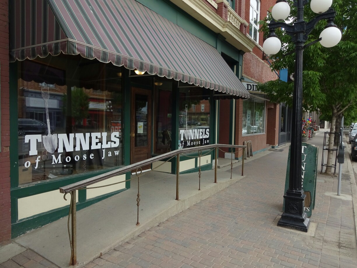
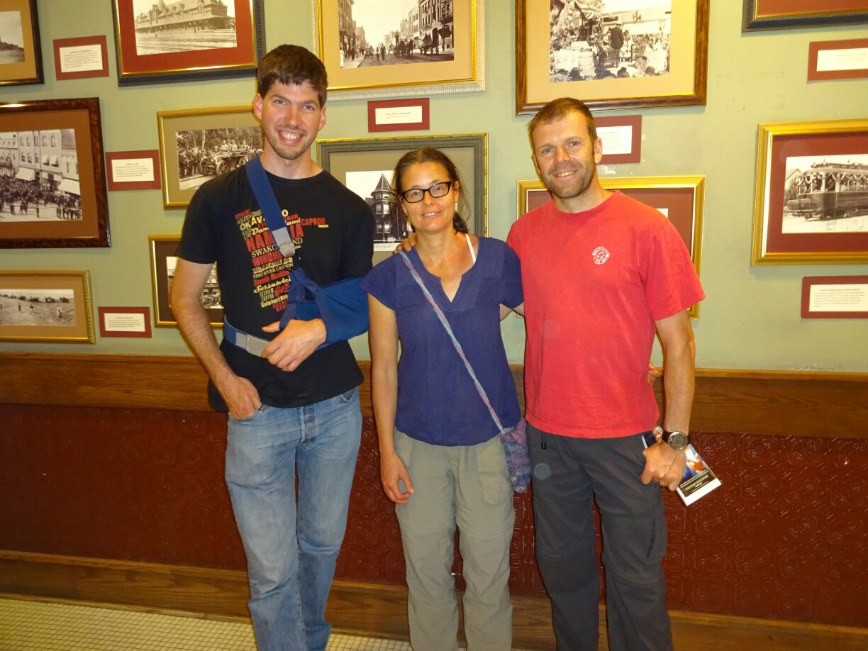
Luckily we found some nice people at the otherwise deserted parking lot, who gave us some bug spray. The smell was strong enough that it made the ticks let go so that we could take them off. But even if we managed to take off all of them, it was still itching everywhere for the rest of the day and we got a little paranoid thinking that we still had ticks crawling all over our bodies. Since we still wanted to visit the “Tunnels of Moose Jaw”, we had to live with that feeling for the rest of the afternoon, before we could take a shower and dry clean our clothes.
Downtown Moose JawThe actual entrance to the tunnels is located across the street
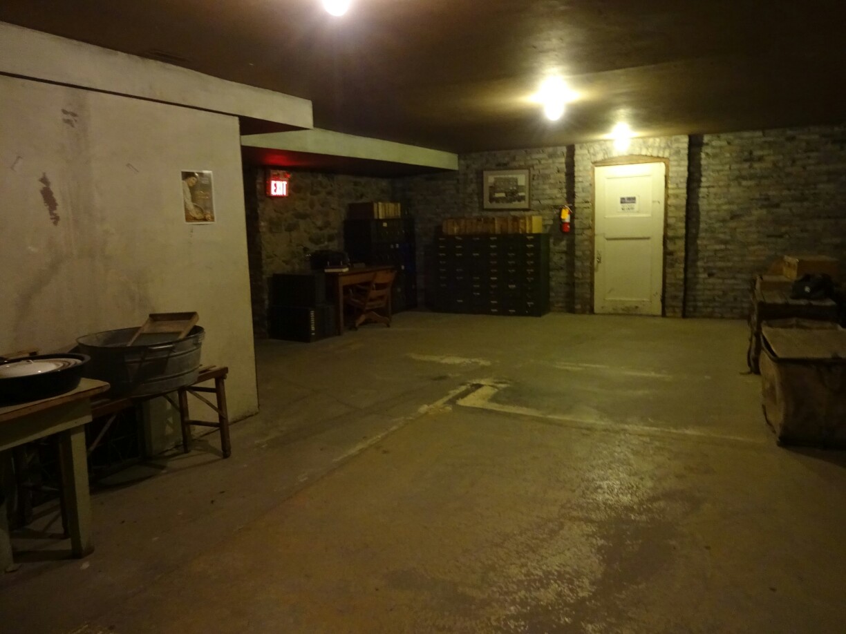
There are two tours offered to explore the tunnels. We decided to find out what Al Capone was doing in Moose Jaw. The famous gangster from Chicago supposedly got his booze supplies during the prohibition from this Canadian town. It is also thought that he came every now and then to hide out when the air was getting too thin. This theory is supported by the railway that connected Chicago and Moose Jaw in the late 1920s. On the tour we got to experience some of the old flair of hidden saloons, tunnels and secret doors.
The tour led through tunnels and secret passages to the basementWe survived the tunnels, but we could still feel the ticks everywhere
The next day we went to the tiny village of Ogema. Although it only has about 400 inhabitants, this town is home to two major tourist attractions: The “Southern Prairie Railway Train Tours” and the “Deep South Pioneer Museum”. Since the train was booked out, we decided to have a look at the large outdoor museum. More than 30 buildings from Ogema and the surroundings have been gathered and restored on the grounds of the museum, most of them are nearly a century old, from a time when the first settlers arrived in this area.
The museum in Ogema gathered more than 30 original buildingsThe collection includes old cars and farm equipment
Besides from having a large number of old farm machinery, such as tractors and early combines, they also had old cars, carriages and sleighs. The buildings included a school, a church, a doctor’s office, a hairdresser and a movie theatre. The interior was full with original artifacts and created a feeling as if the old pioneers were still watching our very moves. It also made me quite happy that I don’t have to put up with the frightening machinery of a dentist from back in the day.
Inside the old school, which was used up until the early 1960sWhen I’m looking at the doctor’s office, I’m glad things have changed
Afterwards we drove up to Moose Jaw once again. This time we wanted to have a look at the “Pow Wow” that was held at the banks of the “Kiwanis River”. This is a social gathering, where the first nations people get together for singing, dancing, socializing and for honoring their cultural heritage. In our case it was an intertribal event and open to the public. Visitors could bring their own chairs and sit around the tent with the dancing area.
At the end of the grand entry the flags are placed next to the table of the master of ceremoniesThe traditional outfit with feathers, bells and other decorations is called “regalia”
Even if we had missed the opening ceremony and most of the grand entry, it was still very impressive. Men, women, young and old were wearing their traditional clothing, known as “regalia”. They were decorated with feathers, fur, little bells and even turtle shells. Located around the dancing area were several drums, which were played by a group of six to eight people singing traditional songs. It was a very powerful experience and you could feel the energy from the dances and the drums in the air.
The women dancing together before splitting up according to age groups and dancing stylesThe drumming circles were responsible for the beat and the singing and don’t need to dress up
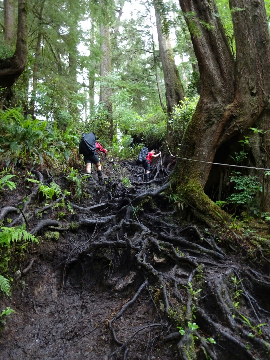
After our night at the “Eagle Beach”, we managed to take down our tents during a short dry period. With everything packed up and ready to go, we continued our hike to the “Nitinaht Narrows”. The trail was becoming muddier and we encountered first signs of bears, who had decided to place their poop in the middle of the trail. A little later we had to climb over massive slippery root systems to reach the bank of this silent, but strong current.
The boardwalk was more deteriorated as we continued our hikeLuke and Heather climbing the massive root systems
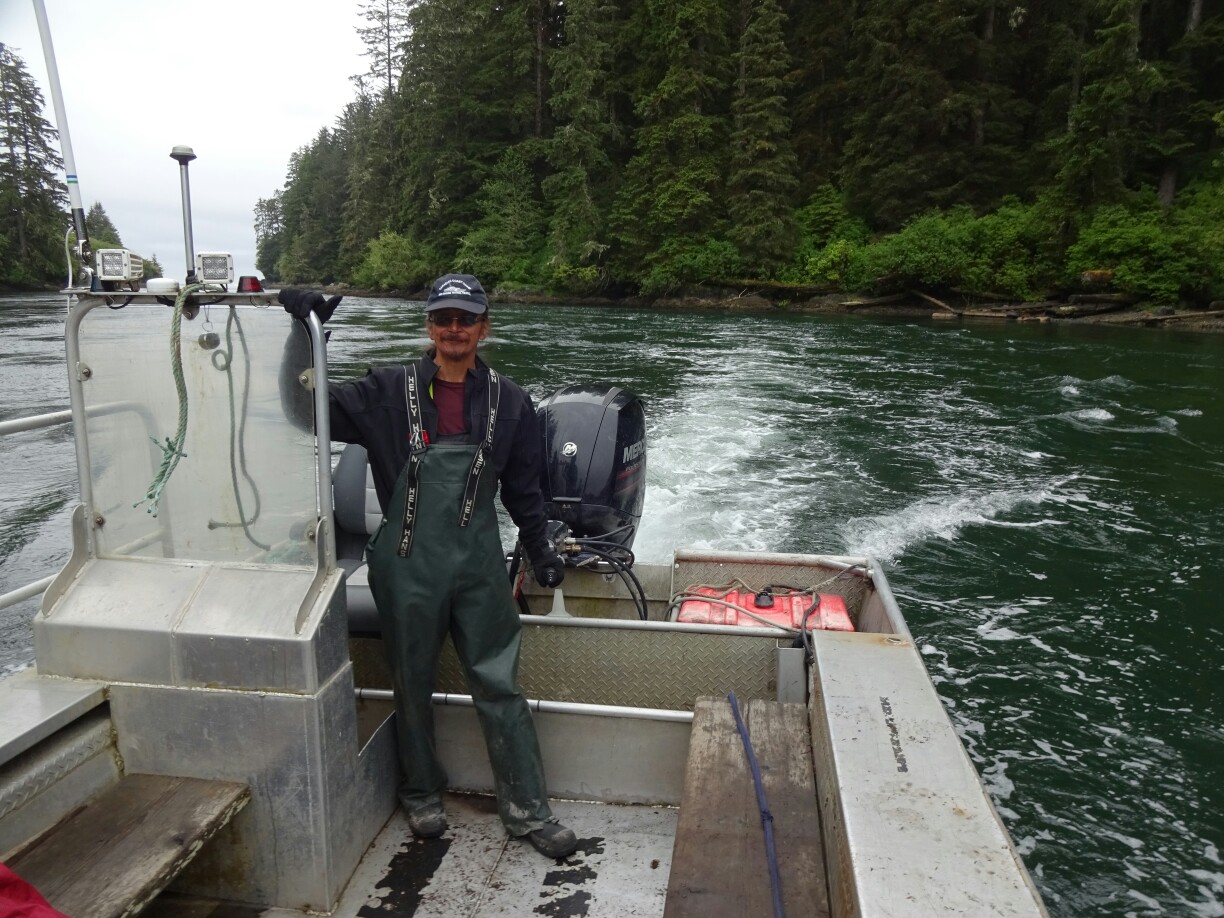
Perry the ferryman came over to pick up Heather, Luke and me. He had good news for us, as the weather forecast was predicting nice weather for the next few days. This would be very helpful for conquering the large ladders and mud holes that were yet to come. On the other side we met Harold and Susan again, who had left camp before us and were now celebrating Susan’s birthday with the delicacies of the “Crab Shack”.
Perry the ferryman had an updated weather forecast for usHarold and Susan enjoying the birthday lunch at the “Crab Shack”
As it was still early in the day, Heather, Luke and I decided to continue walking. We were able to make good mileage on the next section, which consisted of newly built boardwalks. After a nice picnic at “Cheewhat River”, we followed the beautiful beach, where camping is forbidden to an abundance of wildlife in the area. However, we saw neither bear nor cougar, but I’m sure they were watching us, well hidden in the dense forest.
With the newly built boardwalk we avoided the swampy area around the lake at “High Place”It was forbidden to camp at this beautiful beach section due to abundant wildlife activity
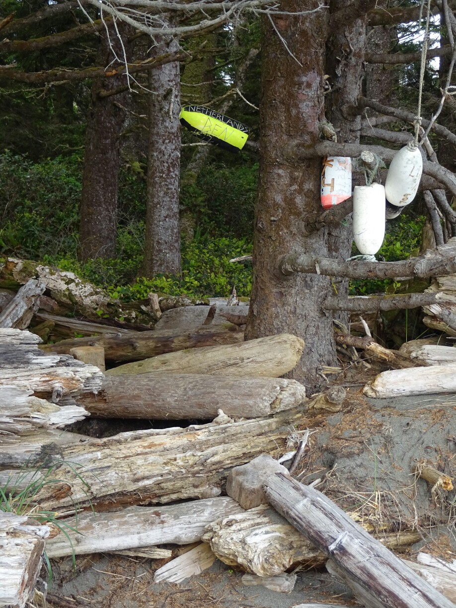
At “Cribs Creek” (km 42) we decided to set up camp between the mounds of driftwood. It wasn’t long before Harold and Susan reached the camp and shortly after, Sarah, Lisa and Mel also arrived. Everyone was quite tired from the long day and nobody wanted to move more than necessary, so the tents ended up being spread out with several campfires going. Everyone wanted to dry the damp clothing and warm up before heading to bed.
Camping between the driftwood at “Cribs Creek”
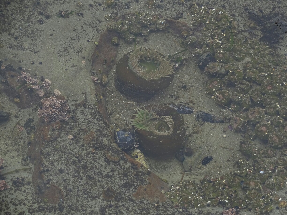
The following day we continued along the beach towards the “Carmanah Lighthouse”. I was the first one of our little group to leave the campsite. As I was walking down the beach, I saw a sudden movement between the rocks. It was a small, chocolate brown river otter that was searching for food in the intertidal zone. Very happy with this sighting, I started the ascend of the steep ladders up to the lighthouse.
The tidal pools in the rocks were pretty interestingThe river otter in search for some food
By the time I had reached the top, a slight drizzle had picked up. Therefore, I just had a quick look around. After admiring the views and the enormous whale skeleton, I headed back down to the next beach, where I sought refuge at “Chez Monique”. This is a well known stop among the hikers of the “West Coast Trail”, where Monique and her family serve delicious burgers and other long desired treats in their walk-in tent with plastic tables and sand floor.
Monique has been operating her little restaurant for yearsThe burgers are enormous and really delicious, especially after days of trail food
After everyone had caught up with me and enjoyed the pleasures of this eatery, I joined Sarah, Mel and Lisa for the next section of the trail. With the picturesque lighthouse still in view for a long time, we followed the rocky shores past “Bonilla Point” and all the way to “Walbran Creek” (km 53), where a beautiful campsite was waiting for us on the other side of the river. Instead of using the cable car, we put on our sandals and waded through the rapidly flowing water.
Great times with Sarah, Mel and LisaThe “Carmanah Lighthouse” was still visible from far away
We spent the rest of the evening cooking, drinking tea and enjoying the nice sunset, which seemed to fulfill the promise of better weather. Unfortunately, I forgot my chocolate brownies that I had bought at “Chez Monique” in front of my tent. But instead of foraging bears it were the mice that found my food immediately, eating up my treat that I had saved for the following day. What a shame!
Watching the sunset at “Walbran Creek”The campfire was an important part of every evening
Harold and Susan had met their goal and were the first ones to leave the next day. I followed about an hour later on my own, since the others were not quite ready yet. The first five minutes on the trail already gave a good overview of what was waiting for us that day: Mud and ladders. However, after the first hour it seemed like I had made a good distance, so I sat down to eat the chocolates that I had gotten from Sarah this morning. Afterwards I must have been so relaxed that I didn’t pay enough attention and slipped on a wet log. The next moment I was sitting in the mud that I had been trying to avoid.
It was tricky and not always possible to avoid the large mud holes
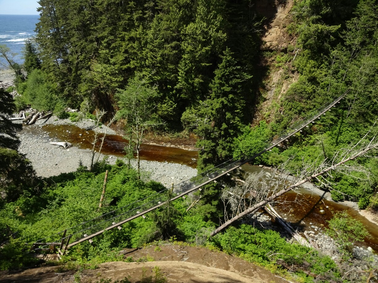
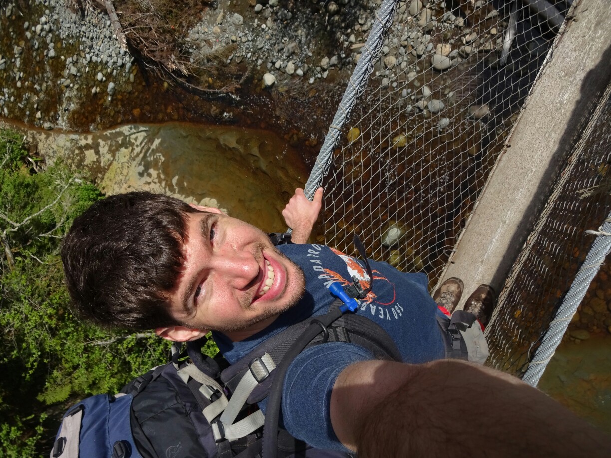
Despite being covered in mud, I was still feeling fine. My shoulder was hurting a bit, but I rested a few more minutes and then put my backpack back on and continued. At the long ladders that led down to the suspension bridge across “Logan Creek”, I realized that I could not really put weight on my left arm. Somehow I still managed to get across and was quite happy to see Harold and Susan on the other side of the cable car at “Cullite Creek” (km 58), who helped me to come across.
The large suspension bridge at “Logan Creek” is only wide enough for one personMy shoulder was hurting, but I was trying to make the best out of it
After an extended lunch break we decided that it was best for me to wait for Mel, who happened to be a nurse. Soon enough they reached us and she had a look at my shoulder. A bit disappointed, I accepted her diagnosis of a possibly cracked clavicle and decided to stay in place, while sending out my emergency paper with Harold, as there was no cellphone reception available. He would drop it at the next guard cabin at “Camper Creek”, another four hours away.
I accepted the possible diagnosis of a cracked clavicle and ended my trip at “Cullite Creek”
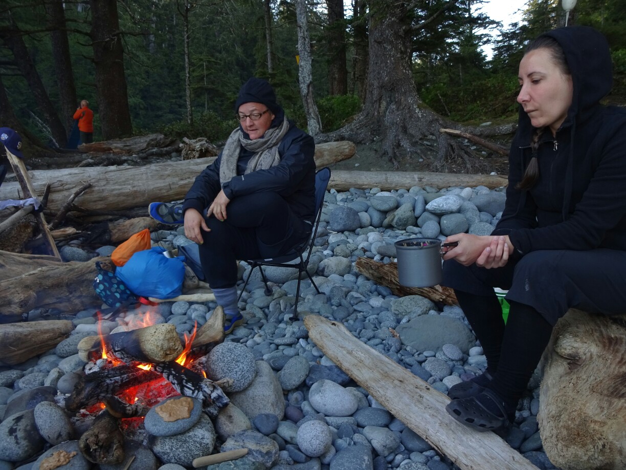
Luckily there was an official campsite at “Cullite Creek”. What was even better, was the fact that Sarah, Mel and Lisa had planned to stay there anyways. Soon it was clear that my rescue boat was not going to arrive before the next day, so we set up camp. Later, a group of eight men (all from BC) joined our campfire and cooked salami and cheese on flat rocks next to the fire, which somehow worked much better than our attempts of pancake “on the rocks”. As the evening progressed, the ongoing conversation quickly turned from old jokes to physical and philosophical discussion about space and the origin of the earth. There could have been worse places to end this trip!
Pancakes “on the rocks” did not really work“Cullite Creek” was definitely not a bad place to end this trip!
After everyone had left the camp, I slowly packed my backpack and sat down at the beach to wait for help. Several boats and a helicopter passed by my cove, but none of them seemed to have any interest in me. The day progressed and I was wondering, if the promise of help within 24 hours would hold true. But sure enough, eventually a zodiac boat came to pick me up after a quick check-up. They brought me to the southern end of the trail, where I changed to an ambulance that took me straight back to the hospital in Victoria for some x-ray pictures.
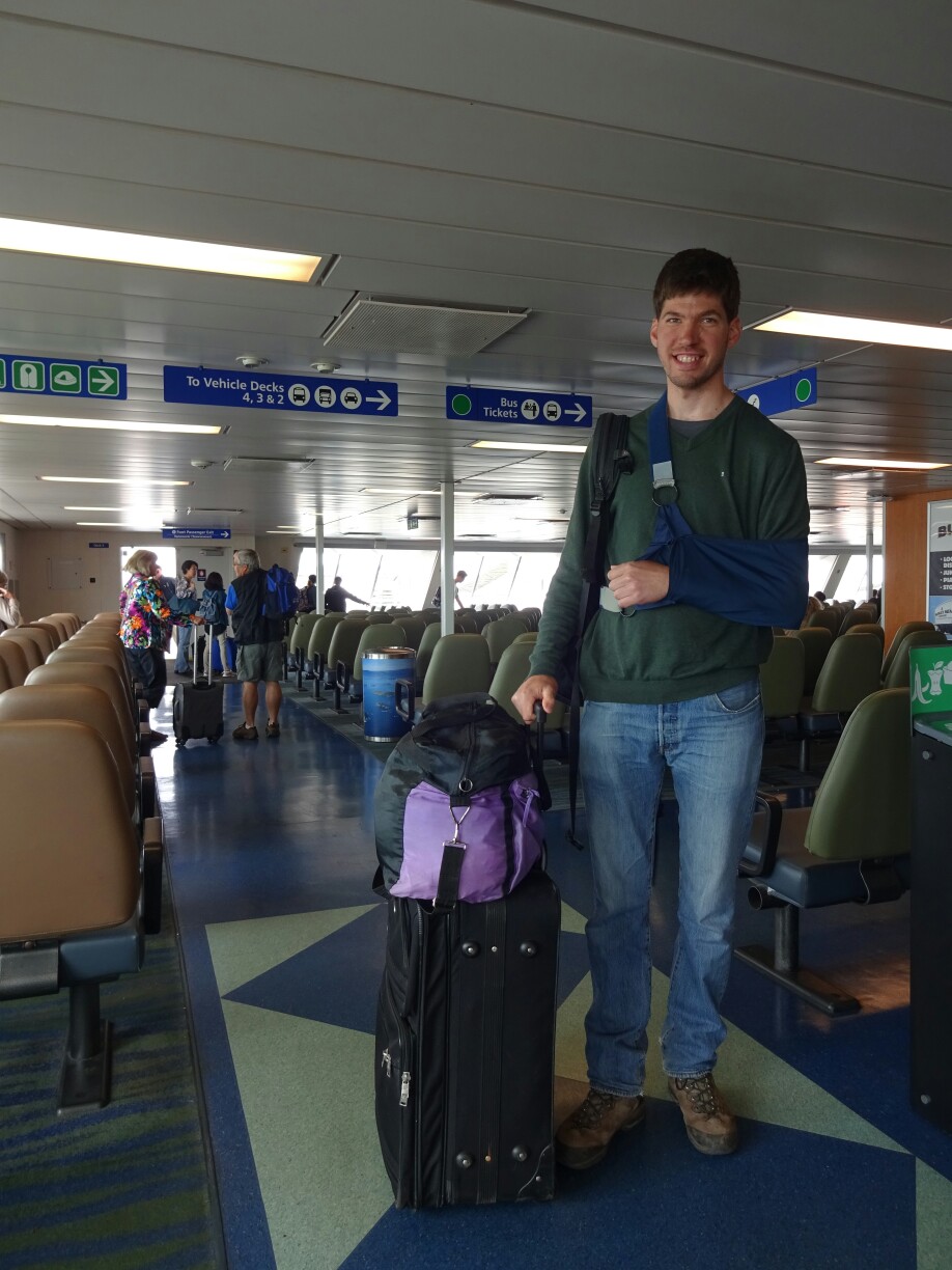
After nearly 24 hours the rescue boat finally came to pick me upMel’s diagnosis was correct, which means that I had to trade my backpack for a suitcase
Within 24 hours of being on Vancouver Island, I had decided against going to the north part of the island and instead for going on the “West Coast Trail”. This is a famous Canadian multi-day hike on the isolated Pacific coast between Pachena Bay (Bamfield) in the north and Gordon River (Port Renfrew) in the south. It’s about 75 kilometers long and takes about six to eight days to finish, if you’re not rushing through this beautifully rugged landscape.
Magical forest boardwalks are waiting on the “West Coast Trail”Forest and beach walks alternate
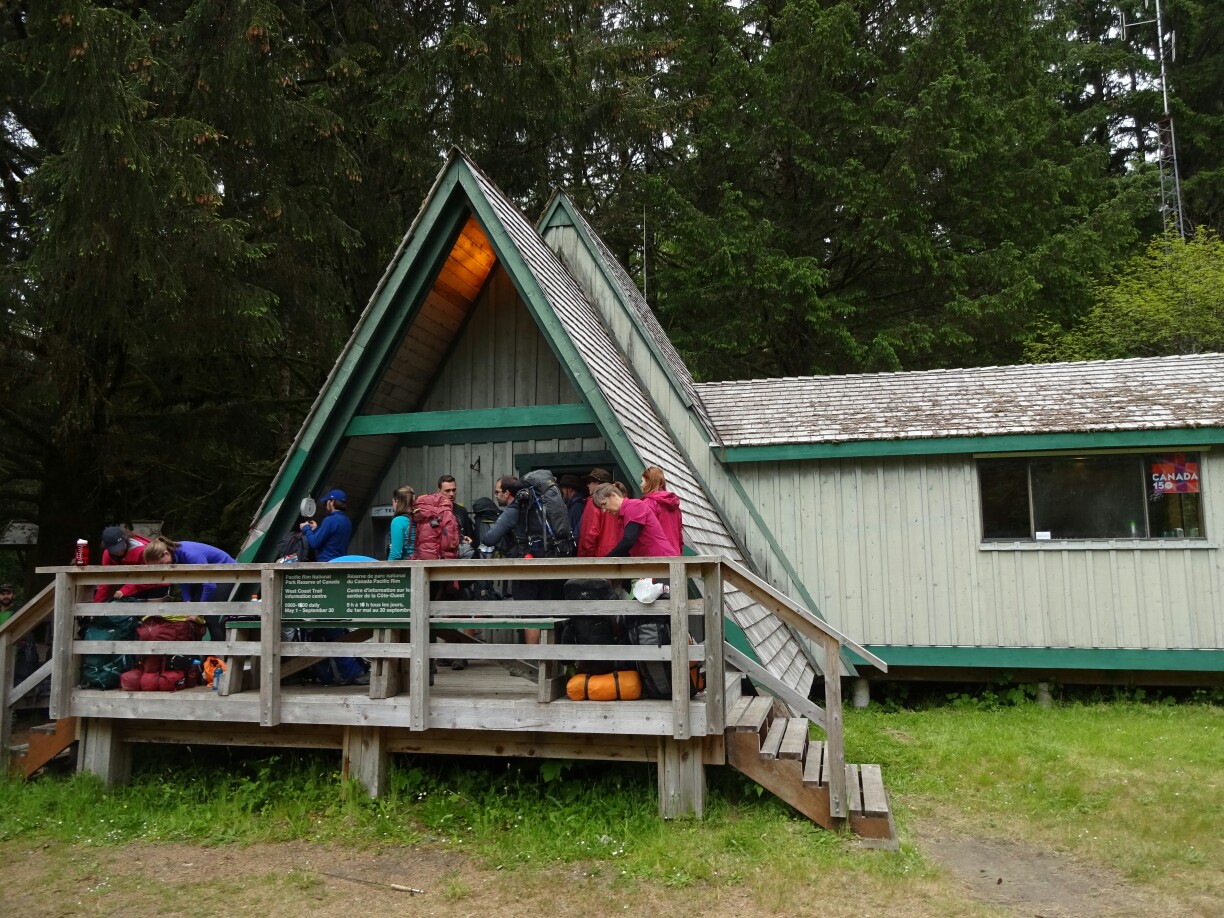
Due to the restricted access it’s usually booked out months in advance. Luckily I was able to get a space within a few days, as it is still low season. This was also the reason why I had to take the bus one day early, because in May it only runs every second day. With enough food for eight days I boarded the bus early in the morning and got dropped off in Pachena Bay for an early group briefing with one of the park rangers. Again, luck was on my side and I was able to start the same day. The “Trail Bus” connects Victoria and the remote cities on the west coast
While everyone was waiting for the briefing, I weighed my backpack – 23kg
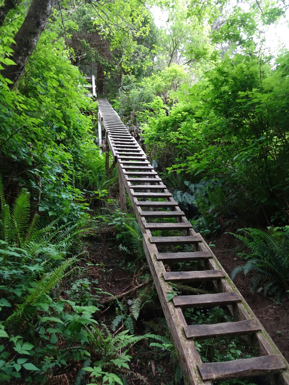
After learning about how to behave in case of an encounter with a bear, wolf or cougar or what to do in case of a tsunami, the tide was too high for the first beach section, so everyone had to start off with the forest trail and the first ladders, giving us an impression of what was waiting for us at the southern end of the trail. And even if everyone started at the same time, it quickly spread out and I was on my own. The trees around me were lush and green and full of moss.
It’s time to hit the trail!These ladders were a first impression of what was waiting for us at the southern part of the trail
For most part of this day, the ocean was far off in the distance, the sounds of breaking waves were unable to reach the trail through the thick forest. After about two hours the trail led to a hidden viewpoint from the top of a steep cliff overlooking a rock filled with sea lions. A little later the trail passed the “Pachena Lighthouse”, which was built in 1907 as a response to the wreck of the “Valencia”, where more than 130 people had lost their lives a year earlier.
Sea lions on a rock just off the coastThe “Pachena Lighthouse” was built following the wreck of the “Valencia”
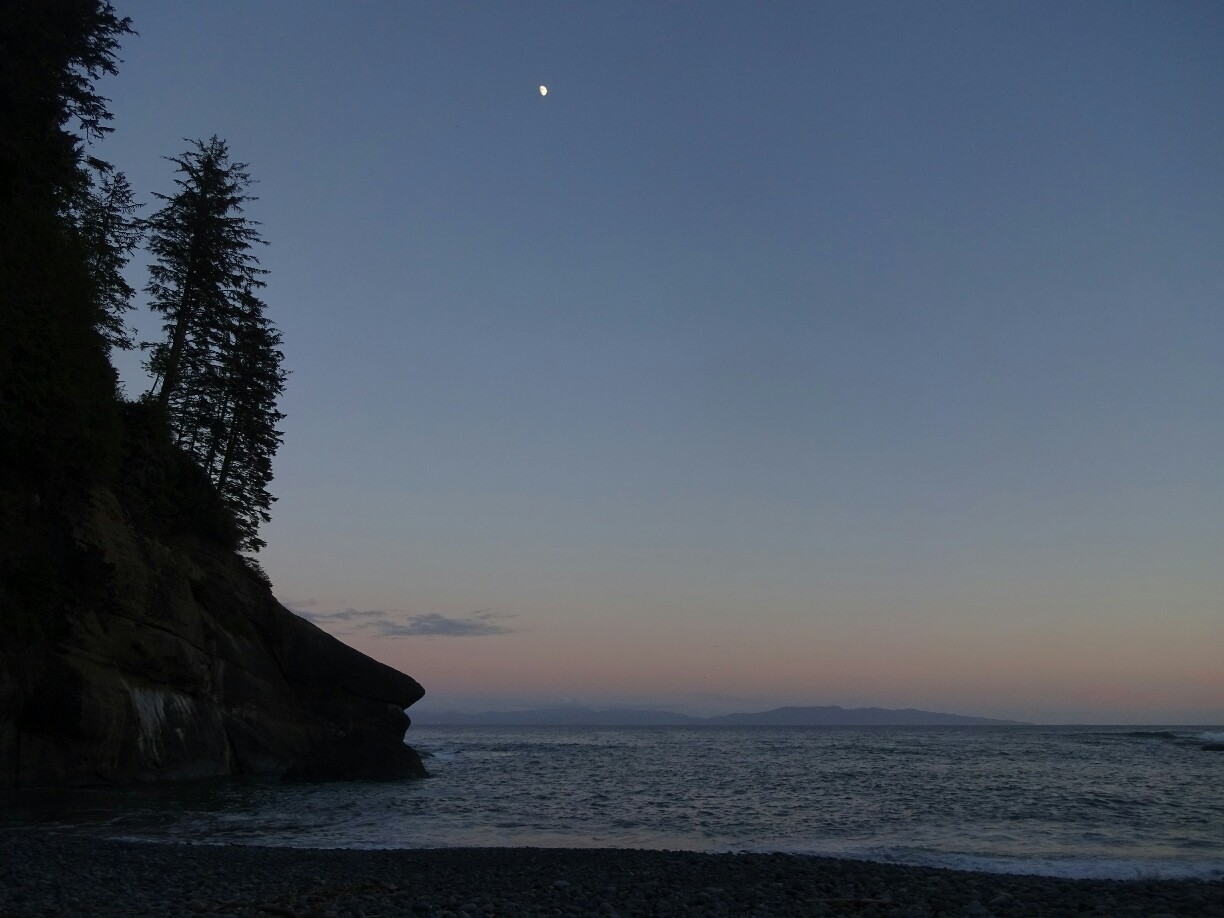
But the “Valencia” was not the only ship that sunk at this treacherous coastline, where the rocks are never far from the surface of the ocean. Many other ship wrecks led to the nickname “Graveyard of the Pacific”. So maybe it was not a coincidence that I encountered numerous trail ghosts along the way, some of them definitely causing goosebumps. At “Michigan Creek”, the first campsite (km 12), these ghosts were even talking to me by sending a pod of Orcas along the coast. I decided to listen and set up my tent instead of continuing to the next one.
Some of the trail ghosts were huge, but well hiddenArriving at “Michigan Creek” campsite
The next morning I got up without a rush and was rewarded with a spectacular fight of three bald eagles over some food. What a great start of the day! But the trail ghosts had more pleasant surprises for me up their sleeves – they introduced me to Sarah (ON), Mel (BC) and Lisa (BC), three Canadians with more food than they could carry, as well as Heather and Luke from Duncan (BC), whom I had briefly met the day before and who let me join them for parts of the trail.
Despite the clouds, this was a spectacular start to the first full day on the trailLisa and Sarah (and Mel) had too much food, so I was invited to get rid of some snacks and trail spirits (picture by Sarah Main)
The trail continued with a mixture of forest boardwalks and deserted beaches. We decided to call it a day at the picturesque “Klanawa River” campsite (km 23), in order to avoid the crowds at “Tsusiat Falls” (km 25). Only later I found out that this had been planned by the trail ghosts all along, because I found a buoy with my name on it right above the entrance to our campsite. And if that wasn’t enough, we heard from a northbound hiker about a deserted beach at km 31, which would allow us to cut the longest hike in half, making use of my spare day.
I joined Heather and Luke at most campsites like here at “Klanawa River”
After setting up my tent I realized that this spot had been reserved for me
The following day started with blue sky. Quite a nice surprise, as we had been expecting the rain that was forecasted for today. But we didn’t need to wait for long – after we had successfully crossed our first river by cable car and reached the beachfront once again, it was starting to get wet. However, it was neither the spray from the “Tsusiat Falls” nor from the pounding waves, but a slight drizzle that would have soaked everything had it not been for my bright red poncho.
For sunset and sunrise we enjoyed the dark blue skyAt “Tsusiat Falls” the forecasted rain had reached us
It was still raining as we reached the desolated beach (km 31) just past the “Comfort Camping”, a service that is offered by the local First Nations at an additional cost. Sarah, Mel and Lisa decided to skip the rain and take up the offer, as well as leave some of their excess food with the camp attendants. Heather, Luke and I decided to fight the rain and set up our tents as soon as we had a little break from the rain. Not too long after we were joined by Harold and Susan from Toronto (ON), who had also heard of this spot at “Klanawa River” last night.
Hiking through the rainDefying the rain with campfire and marshmallows – Luke, Heather, Susan and Harold
While we were preparing our dinner under the tarps that we had set up, some more bald eagles were watching us from the small rocky islands at a safe distance. The cracking fire that Luke had managed to ignite despite the constant rain and the roaring waves that the wind was pushing to the coast just added to this awesome moment where I felt like I was the only foreigner on this truly Canadian trail.
Wind and rain made camping at our private “Eagle Beach” pretty exciting
After camping at “Cultus Lake”, Ash and I returned to Vancouver around midday. The day was really nice and we decided to go on a little bike tour around the city. We went down to the water, where everyone was enjoying the last day of this long weekend. The people were laying on the grass with a magnificent view of the “False Creek Bay” and the glittering skyscrapers of the downtown area.
The neighborhood of “Mount Pleasant” shows that Vancouver has more to offer than skyscrapersLocals enjoying the sun at “False Creek Bay”
We biked all along the water to the famous “Stanley Park”, the large forested area in the north of the Vancouver peninsula. Along the shore, a bike path and walkway lead all around the park. However, it’s only a one-way lane for bikes to accommodate the large number of people that come here on a summer’s day. Artwork, swimming pools with ocean view and food trucks wait on the other side to serve the exhausted locals and tourists after completing the 10km loop.
The waterfront walkway passes by the “Brockton Point Lighthouse”Finishing the long weekend with a nice bike tour through Vancouver
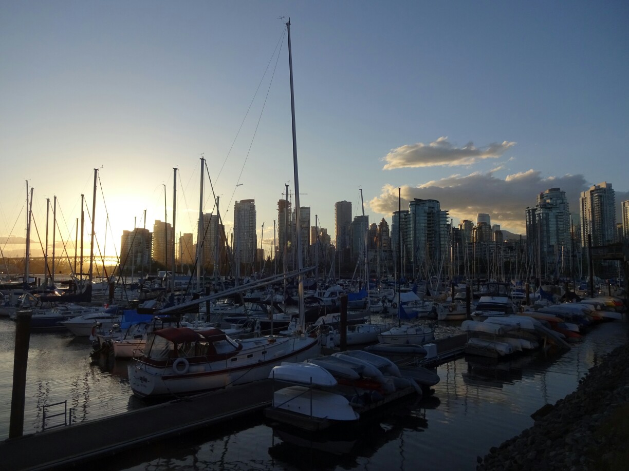
Since Ash was busy with work and had an appointment on the following day, I set off to explore the city on my own. This time the air was a bit cooler and a strong wind was blowing from the sea. The setting sun illuminated the skyline with a warm glow and it was easy to see, why Vancouver, named after the captain who led several major expeditions in this part of the continent, has been continuously named as one of the best places to live in the world.
The next day the strong wind had emptied the streetsThe downtown harbor reminded me a bit of the “Alster” in Hamburg
Another day we met up with Andrew, who graduated with us from high school in Maidstone back in 2005. He is now an earthquake specialist for landslides and moved to Vancouver after finishing his bachelor degree in Edmonton, which is where I met him last time. The second time we were joined by Ryan, who is developing computer games and also graduated with us from Maidstone. Neither Andrew nor I had seen him since. It was really nice to catch up and see what they had been up to.
There are many little parks around “False Creek Bay”Catching up with Ash, Andrew and Ryan
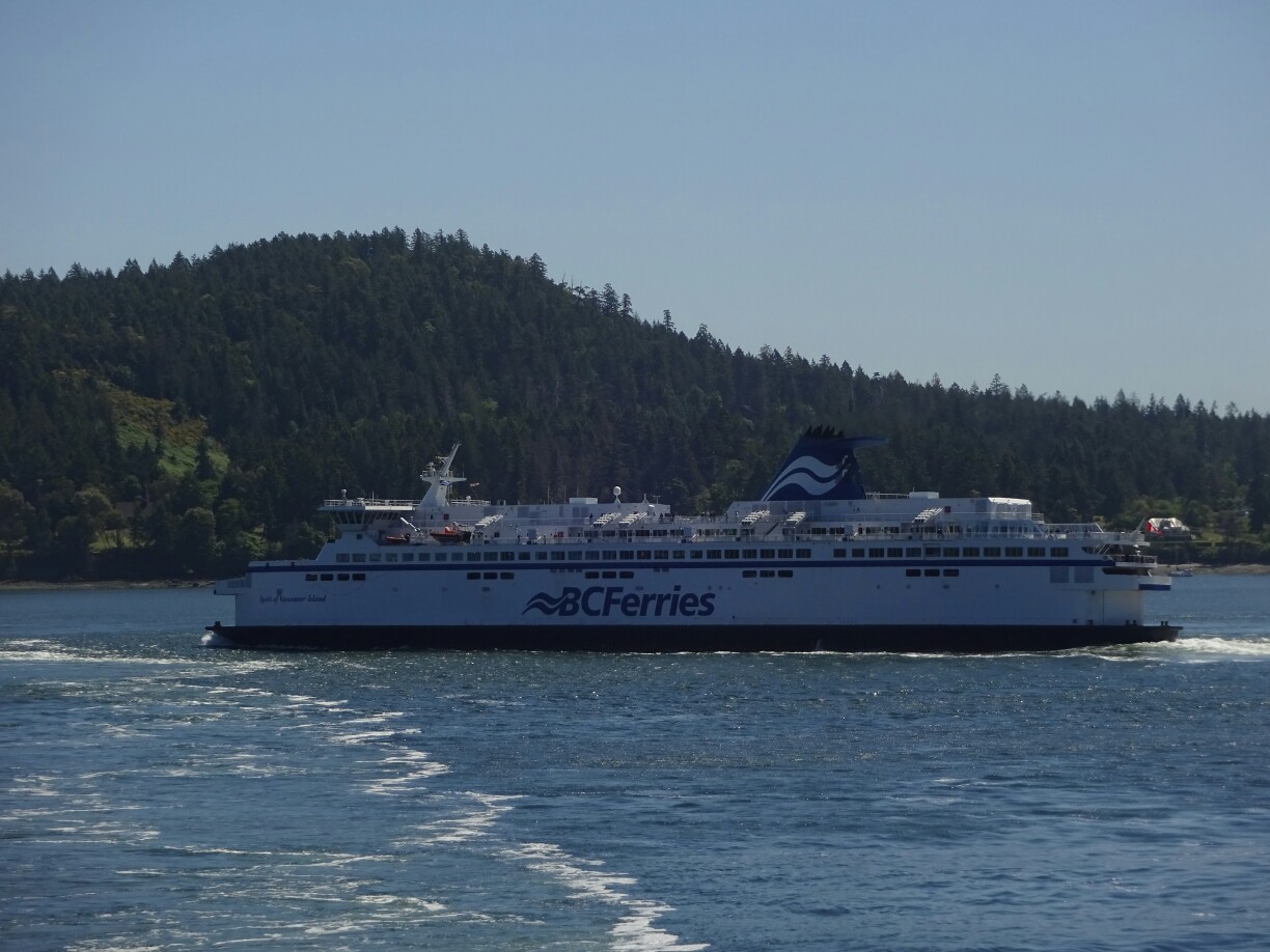
Since I had two weeks to spare, I decided to go to Vancouver Island once again. With my parents and my brothers I had visited Tofino, Ucluelet and Victoria back in 2006. These are also the places that most people visit during their first time on the island. But the island is much bigger than that. I was thinking of going up north, if I could figure out a way of getting there. However, my first stop was Victoria, after a nice ferry ride through the “Strait of Georgia”.
The “Spirit of British Columbia” took me over to Vancouver IslandWatching boats and islands on the cruise through the “Strait of Georgia”
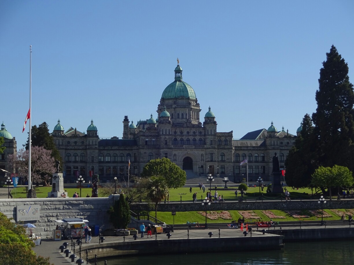
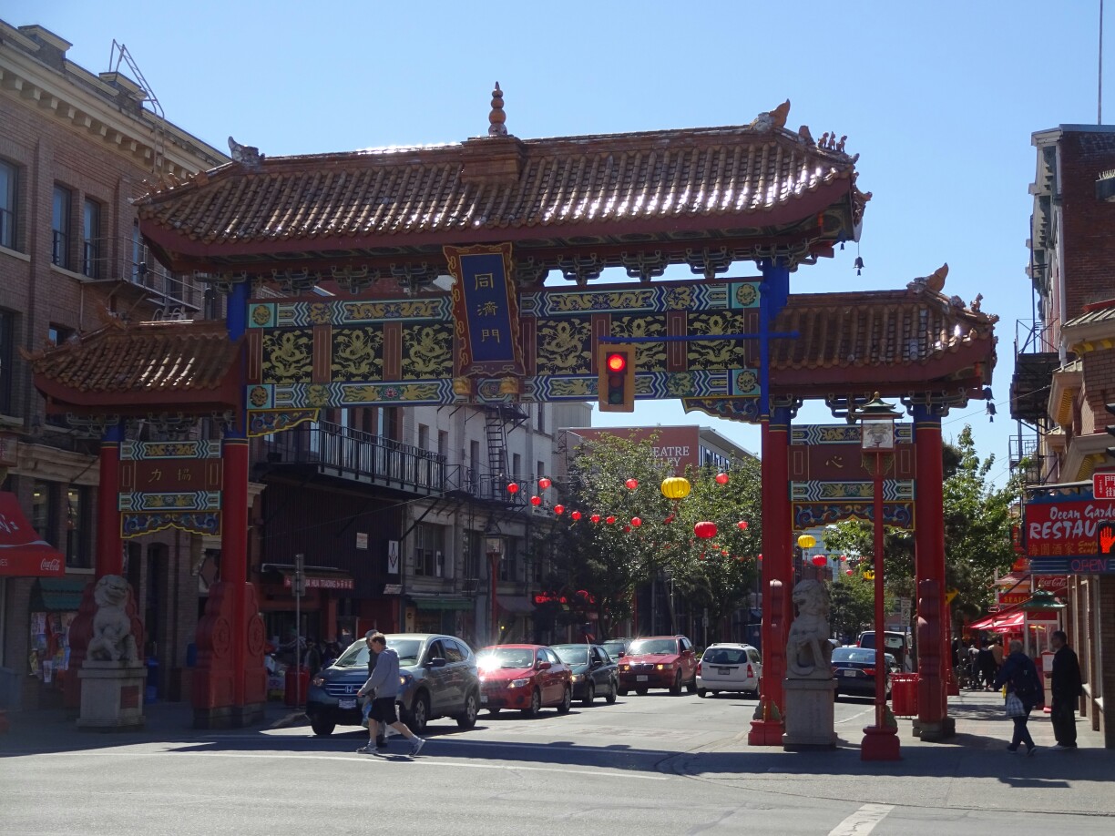
Victoria is the capital of British Columbia and one of the oldest cities in the Pacific Northwest. It was named after the British Queen ruling at that time. It is much smaller than Vancouver and lacks the glittering skyscrapers, but definitely has its charm. Old and impressive buildings include the “Fairmont Empress Hotel”, the parliament of British Columbia or the gate to Chinatown. The Chinatown itself is the second oldest in North America after San Francisco.
The parliament is located right at the harbor of VictoriaChinatown is small, but it’s the second oldest in North America
“Mount Douglas” provides an excellent view over the city, especially at sunset. At that time the coastal mountains of Washington, just on the other side of the “Juan de Fuca Strait”, get a red glow. The same view without the city can be seen from the shores of the “Beacon Hill Park”, which is also a perfect place to practice the speeches for the theater play of “Macbeth” as I found out from the leading actor.
The view from “Mount Douglas” over Victoria and the snow covered mountains of WashingtonThe shore of “Beacon Hill Park” is perfect for practicing Shakespeare’s “Macbeth”
And somewhere along those lines I came up with a better plan for the following weeks: Hiking the “West Coast Trail”, a famous multi-day hike north west of Victoria. I spent a full day booking all the required permits and busses and preparing for the trip. But since I couldn’t start right away and all the hostels were booked out, I decided to prepare also mentally by camping and hiking around “Thetis Lake”, which is just out of town.
“Thetis Lake” is located just on the outskirts of Victoria and popular with the localsHiking around the lake in preparation for the “West Coast Trail”